Wednesday, 28 March 2012

The Mystery of Glen Uig and Fairy Glen

Jo reckons Glen Uig/Gleann Conain is a wide glacially sculptured valley with its origin higher up in the Trotternish Hills and that is a very plausible theory, but the landscape of Fairy Glen is something else. It bears a strong resemblance to how one might imagine Hobbiton in The Lord of the Rings and there are clear signs that some people do regard this spot as having some form of "preternatural ambience", though geologists would probably use terms such as igneous intrusions and volcanic shrapnel to bury any fanciful thoughts of dwelling places of fairies and pixies who only come out at night.

Glen Uig, at one time bearing a massive glacier westward into Uig Bay.


Looking south across Glen Uig to Fairy Glen, said to be formed from landslides followed by glaciation.


River Conon


Entering Fairy Glen.


Fairy car park


Looking north from Fairy Glen over Glen Uig.


Can you spot Laa-Laa and Tinky Winky?


Notice the Norah Batty-like wrinkly surfaces which Jo attributes to weathering rather than gravity.


Palace of the Fairy King or basalt intrusion.


Trotternish hills look down into the valley.


Icy stream.


A soft iron-rich rock.


Castle Ewen. Note the dark larval layer containing a ribbon of red rock.


Castle Ewen.

Tuesday, 20 March 2012

Gneiss time at Point of Sleat

It was a cool and cloudy day for the group's first visit to the Point of Sleat on the southernmost tip of Sleat Peninsula in south east Skye. Most of Skye has a volcanic topography, but Sleat is an exception. I can't begin to explain the complex geology of this area properly but suffice it to say that rocks were layered, with the oldest, Lewisian gneiss, at the bottom, followed by Torridonian sandstone and shale, then Cambrian quartzite and Durness limestone. The 3 major thrust faults Moine, Tarskavaig, and Kishorn messed things about a bit, introducing the metamorphic rock Moine schist and moving gneiss from the basement to the top floor. Some igneous intrusions are thrown in for good measure. Anyhow, it's all beyond me.

Looking south east across the Sound of Sleat to the Scottish mainland.


What was this again?


Shale layered between igneous rock?


A sandstone layer?


Isle of Eigg


More stuff


Is this a layer if Cambrian quartzite or what?


Something was pushing too hard and it got bent.


Falling


Coastal cows


Volcanic plug or lava lake?


Wednesday, 7 September 2011

The Quiraing Expedition

The 5 trepid explorers met at the house of Uig Jo for a caffeine-containing potion and a tasty home-made date slice. As we sped through the valley of the River Rha in the luxury Mercedes we passed an old man in shorts and a deerstalker hat. Many miles later he strode casually by us on the Quiraing and we managed to hold back from pushing him over the edge.

Looking south, left to right: Loch Leum na Luirginn, Loch Cleat, Cleat, Dun Dubh.


Cnoc a Mheirlich, from the north east.


Looking north east, Cnoc a Mheirlich in the foreground, the Prison sloping up in the background.


The cliffs of Maoladh Mor on the left.


With admirable nonchalance, the group leader goes to the aid of a U3Aer encountering difficulties on a steep rock face.


Twixt Needle and Prison.


The Needle


A rock goblin running along the cliff top (according to our group leader).


Two rock creatures guard an entrance to the underworld.


Looking down at Staffin beach.


It was time for elevenses and a lecture by our resident geology graduate Dunvegan Judy on the geology of Trotternish. This was slightly in need of updating as her degree is apparently Precambrian and major geological events have occurred in the meantime. This was followed by a geology quiz featuring questions on the structure of the Earth. Uig Jo won the first prize, a not too badly dented tin of Co-op baked beans, and runner up Judy was presented with a rather hard organic pear. A query was floated as to the origin of the strange sloping structures shown below.

Cleat and Dun Dubh in the foreground, Beinn Edra in the background. Group leader Uig Jo, demonstrated the mechanism whereby these rock formations arose by pushing my sandwich box so that the bird, flower, and butterfly books perched precarioulsy thereon, collapsed into a slope. Once again, the devastating, incisive intellect of our group leader had cut through a complex, seemingly insoluble problem like a hedge trimmer through rice pudding (with a blob of strawberry jam, stirred so that everything goes pink). In the mere flick of a finger on a sandwich box she said "the underlying sedimentary rocks have collapsed under the weight of the basalt, tipping everything sideways to form the distinctive landslips".


On the way back we clambered through heather and bog up the 300-metre high Reieval, sustaining significant midge injuries in the process, to gain a beautiful view of Uig Bay and the north west Trotternish plain, and across Loch Snizort to Waternish and the Outer Hebrides. Finally we were given lemonade back in Uig and sent on our way with mounds of giant cabbage leaves and spinach.

A spiffing day out which not only added to our cabbage coffers but also expanded still further our ever-expanding knowledge of the geological world.

Monday, 22 August 2011

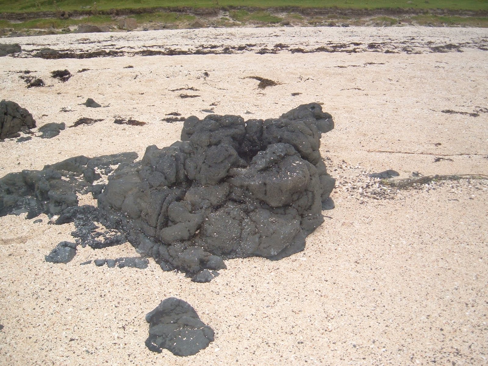
Coral Beach Lava

This photo from Louise shows a rock on Coral Beaches. It looks to me like basalt lava, highly eroded by the sea. There are of course whole cliffs of basalt lava at Talisker Bay but that's quite a distance away, so it would be interesting to know whether there is a lot of basalt lava under the sands at Coral Beaches and, if so, why there are no laval cliffs here as at Talisker Bay


Wednesday, 3 August 2011

U3A Geology Group and the case of the missing Pahoehoe Lava

18th June

The expedition set out from the House of Sheena at Portnalong where we were plied with elder flower cordial on a terrace set in a sea of ferns as the sun hurled down trillions of shimmering photons on us heads from an azure blue sky. The road to Talisker Bay led us through a desolate moorland along Gleann Oraid and we emerged at the hamlet of Talisker in cool glow of episodic drizzle.

Talisker Bay


The search then began for the pahoehoe lava which Jo had seen Tony Robinson reveal in this very bay in the Channel 4 series Building Britain, and Bruce contributed enthusiastically depite being severely castigated for leaving his sandwiches in the car.


Life on a wall of lava


Preshal More, a solidified mass of lava from the central chamber of a long since eroded volcano


Fool's pahoehoe in the sand


Beneath the laval tsunami


It was like the quest for the dinosaur's footprint all over again. The entire area was scoured but there was no sign of ropy lava or ripply rocks. Was it under sand or seaweed, was it all a hoax? The party grew restless.


The mission dissolved in a wave of  frustration and recriminations. Had they but known how close they were to finding that rare, ripply, elusive treasure that is pahoehoe lava.